The NEXTGEN Serious Game: learning about Circular Economy of water in an urban catchment
Serious Games are games developed for a purpose other than mere entertainment. In the context of the NEXTGEN European research project, an educational Serious Game standing at the intersection between decision support system, interactive visualization, and learning sandbox has been developed. The Serious Game allows participants to watch over “ToyTown”, a virtual urban catchment with a population of around 300 000 inhabitants. The objective of the game is to maximise the benefits of Circular Economy in a water system.
Players can change settings in the game to observe the interactions between different components in the urban water cycle and their effects on water availability, energy use, material recovery, environmental health, and costs.
The result is an online browser-based single player Serious Game that tells “stories”, showing different ways the urban water cycle can be affected by enabling various water technologies inside households and at the infrastructural level. The effects of the change initiated by the player are immediately analysed in the background via a System Dynamic Model. This model is specifically developed using the Julia programming language, showing simulation results over 20 years in under a second. Participants can explore how their choices change the water quality and environmental flow in a river and impact on the health of the ecosystem. Similarly, the energy footprint resulting from their choices can be visualised, including an emphasis on wastewater treatment with options to recycle not just nutrients but also metals. The decision can lead to surprising savings in both energy and carbon emissions. Actions have multiple consequences, for example, enabling a nature based solution for urban drainage to lower the volume of water going to wastewater treatment plants after a heavy rainfall, will decrease the amount of energy used for treatment and the number of untreated discharges in the river, but will also increase installation and operational costs.
Source: Khoury, M. 2021. The NEXTGEN Serious Game: learning about Circular Economy of water in an urban catchment. Additional drinking water sources and circular economy, Risk & Resilience. AIWW 2021.
Measuring and quantifying the benefits of nature-based solutions in cities
A comprehensive review of the many existing (and still under development) assessment frameworks and indicators for quantifying the multitude of benefits arising from nature-based solutions (NbS) in urban contexts. This includes an evaluation and cross-comparison of tools using multi-criteria analysis as well as the application of the highest-scoring tool on an urban NbS case study in the Netherlands. The focus of the study is primarily on water-related ecosystem services however additional biophysical benefits are also considered.
There are a growing number of tools that attempt to measure, quantify and valorise the well-being and that human societies receive from healthy and functioning ecosystems. However there has been limited adoption of these tools by decision makers and policy-makers, especially in urban settings, which can result in an underestimation of the ecosystem services and societal benefits that are being provided by nature-based solutions (NbS) in cities. In order to facilitate the use of empirical data for greater NbS implementation in urban contexts, it is important to understand the properties of each tool, their suitability for diverse urban environments, and the relationship between indicators that measure NbS ecosystem services with indicators that are intended to assess ecosystem properties (i.e. health, integrity, resilience).
This study first provides a thorough overview and comparison of the wide variety of available assessment tools in terms of their ability to measure ecosystem services delivered by urban NbS. Using criteria from the literature and practical perspectives, a multi-criteria analysis is used to identify suitable assessment tools that can capture NbS ecosystem services across different urban landscape domains and societal challenges. In the second part of this study, the effectiveness of a chosen assessment tool, i-Tree, is tested through its application to an urban park case study in Amsterdam. The aim of the study is to quantify and measure as many ecosystem services as possible from the urban park, which can then be presented as societal benefits within a business case proposal that uses non-technical language but is grounded in scientific evidence. Both the approach and applied tool of this study can be modified and replicated by a wide range of stakeholders to estimate and/or measure the benefits of integrating bluegreen solutions into urban spatial planning. These benefits include, but are not limited to, more resilient and adaptable infrastructure, reductions in flood risk, more efficient and multi-functional land use, and improved environmental quality. In particular, the i-Tree tool is well-positioned for use in citizen science projects.
Source: Alvarado, O. A. 2021. Measuring and quantifying the benefits of nature-based solutions in cities: case study of urban park in Amsterdam. Wetlands for wastewater treatment and Nature-Based solutions. AIWW 2021.
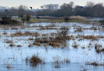
Flood resilient landscapes: area-specific solutions with added value for society and safety
The Netherlands is not finished; there are large spatial tasks and transitions ahead, such as climate change, making agriculture and the energy sector more sustainable, restoring biodiversity, but also, for example, the task of housing construction and ensuring sufficient clean (drinking) water. In the latest IPCC report (August 2021), we see that climate change is accelerating: faster rise in sea level, more intense precipitation and more extreme periods of heat and drought. In short, it is time to roll up our sleeves to keep the Dutch Delta safe and livable.
A complex dilemma arises here: a degree of uncertainty about complex system changes, and at the same time the task of working out the intended transitions within the existing, limited context of laws and regulations, current policy and social acceptance. In short, the task of keeping the Dutch delta liveable and safe demands a systematic future study of adjustments to and in the spatial organisation of the water (safety) system.
In the coming decades regional water authorities together with regional governments and local partners will reinforce flood defences in many places in the Netherlands. How can we together ensure that we make the right decisions and do not regret these investments in 10-20 years’ time? This is a relevant question, especially given the complex societal challenges (climate adaptation, housing, nature development, energy and agricultural transition). Current society, in terms of norms and values, will also change. This calls for insight into future society: which values will we find important and can we accommodate them?
That is why, together with the sector, we are developing the concept of flood resilient landscapes. The underlying principle is to create social added value while promoting or at least maintaining flood risk management and climate change, given (future) spatial and societal developments. The necessary knowledge development takes place through real-world practical cases. We use both forecasting (using adaptive delta management) and back casting methods (e.g. Reframing Process) to develop perspectives on action; on the one hand based on uncertainties around e.g. climate changes, and on the other hand based on certainties and trend for the future society, including the issues that are important for the design by that time.
The flood resilient landscapes concept offers the prospect of keeping the Netherlands safe beyond 2100 at socially acceptable costs and with public support now and in the future, and paves the way towards implementation throughout the international deltas.
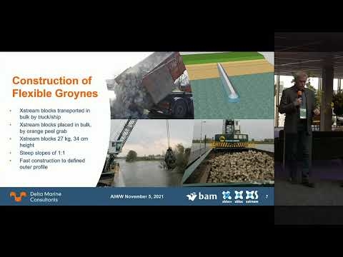
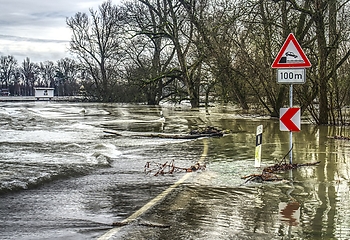
Flexible groynes made of Xstream blocks are the future of river management
Groynes have been applied in rivers for more than 100 years. Traditionally, groynes are fixed structures built from several materials such as sand, rock, pitched stone, fascine mattresses, geotextiles and wooden elements. Main purpose of groynes is to fix the layout of a river and to maintain the depth in the central part of the river for navigation. The groynes guide the river flow to the center of the river and the increased velocities scour the river bed. The groynes also reduce the velocities along the river bank, protecting the banks from erosion.
The existing groynes are impermeable structures which have a large scour protection around the groyne heads. Near the head of these groynes large scour holes are formed due to flow concentration and turbulence. Sand eroded from these scour holes can form local sand waves in the shipping channel (in Dutch kribvlammen). These local sand waves form an obstruction for the inland shipping
Due to climate change the hydraulic boundary conditions for rivers are changing. There is more extreme rainfall, and extreme river discharges increase. The floods which previously occurred only in winter now also occur in summer. Rivers adapt to climate change and also adapt to manmade changes such as shortening the river length by cutting off river bends. Therefore, in the Netherlands river beds are deepening. Because of increasing river flow and changing bed levels, damage occurs at river groynes such as outflanking at the root of the groyne. As the existing groynes have multiple layers and transitions they cannot be easily adapted to the increasing boundary conditions due to climate change.
As groynes are located at right angles to the river flow, they form an obstruction to the river flow at extreme discharges and lead to increased water levels in the river, which are dangerous for water safety. Therefore, at many locations in the Netherlands groynes are being modified by lowering the crest height to increase the discharge capacity. Due to the many layers and transitions in traditional groynes, this is difficult to do. In addition, inland water transport on Dutch rivers is increasing. Inland ships increase in size and have bigger engines. The waves and currents caused by these ships lead to erosion of the bank and outflanking of the groynes, therefore traditional groynes require continuous maintenance.
A concept has been developed by BAM called “Flexible Groynes”. Flexible Groynes are built from only 1 material, called Xstream blocks. Xstream blocks are concrete X-shaped blocks of 35 cm height and 28 kg weight. As they interlock, they can be placed on steep slopes of up to 1:1. The porosity of a Flexible Groyne with Xstream blocks is 60%. So, only 40% of the structure is concrete. Low strength concrete with low CO2 footprint binders can be used. Flexible Groynes are only made of Xstream blocks. So there are no transitions, no geotextiles no rock or wood. The CO2 footprint of a Flexible Groyne is less than half that of a traditional groyne because of the large reduction in material quantities.
The Flexible Groyne adapts to changing river bed levels. If required because of climate change or other reasons, it is very easy to shorten, lengthen or change the height of the groyne. Xstream blocks can be placed in bulk, by dumping or using a crane with a big grab which places 20 blocks at a time.
Because of the porosity of the Flexible Groyne, wave energy of ship waves is absorbed. Since no scour protection with fascine mattresses is required, sand can move more easily around the groyne head and unwanted local deep scour is reduced. Flexible groynes have a high porosity and can therefore form a habitat for river life. During a pilot in the IJssel river in the Netherlands, 3 pilot groynes have been built and monitored in cooperation with the partners (Rijkswaterstaat, Van den Herik, Deltares, BTE, Meteoor and Aquatic Drones) and provided by the leerruimte Self Supporting River Systems. More projects with Xstream blocks are being planned.
Blue-green roofs with forecast-based operation to reduce the impact of weather extremes in cities
Research shows that climate change will increase the intensity and frequency of extreme summer precipitation events as well as heatwaves, over the coming decades. Green roofs are generally seen as an effective climate adaptation measure, but they are also criticized for having a limited water retention capacity during high-intensity rainfall events. Therefore, the city of Amsterdam has started a project RESILIO to investigate a new innovation in this field: smart blue-green roofs. These roofs have an extra water retention layer underneath the green roof, which increases storage capacity during extreme rainfall and functions as a capillary irrigation system for the plant layer on hot and dry summer days.
The smart valve on the roof can be opened when extreme precipitation is forecast to create enough capacity to capture and retain the incoming rainfall. However, it is yet unknown if the forecast accuracy is high enough to provide added value, as false alarms in the forecast can also lead to a reduction of water availability, and therefore a reduction in evaporative cooling and plant health.
To test the magnitude of this trade-off, we evaluate the performance of ensemble precipitation forecasts from the European Centre for Medium-Range Weather Forecasts (ECMWF) to trigger drainage from blue-green roofs. We simulate blue-green roofs in a hydrological model on 28 locations over the Netherlands, using hourly meteorological observations over the last 7 years and different probabilities of the ECMWF ensemble forecasts to open the smart valve and trigger drainage.
We show that this forecast-based drainage creates enough buffer capacity to capture 70-97% of extreme rainfall (>20mm/h). Moreover, evaporation rates relative to potential evaporation on hot summer days is high (around 70%) , and much higher than from traditional green roofs (around 30%). This serves to underscore the higher capacity of blue-green roofs to reduce heat stress.
These results show that blue-green roofs are much more effective in reducing pluvial flood risk and heat stress than conventional green roofs, and that relatively low-resolution ECWMF forecasts can further increase their effectiveness. Initial results of a suitability analysis to upscale this solution in Amsterdam show that approximately 14km2 of roof surface is potentially suitable for blue-green roof application, which is on average 10% of the area of urban catchments. This underscores the contribution that blue-green roofs could make to help cities adapt to the weather extremes of the future.
Living Lab Hedwige - Prosperpolder, a unique opportunity to develop flood resilience
Partners from the Netherlands, Belgium, France and United Kingdom aim to enhance climate change resilience capacity. The overall objective of the Interreg 2Seas project Polder2Cs is to improve capacity to adapt to climate change through increased flood resilience, based on the demands of stakeholders and aimed at a strong overall societal embedding.
Depoldering of the Hedwige- and Prosperpolder offers a unique opportunity for a 6 km2 Living Lab at an operational levee, where innovative techniques, processes and products are tested for practical validation. First series of field experiments such as overflow tests have been performed in Winter and Spring 2021. Also, several emergency response exercises involving partners and observers were conducted. Innovative repair measures such as rock bags have been tested. A dedicated research and exercise program has been developed to be executed in the upcoming period.
To share results, we develop and offer a knowledge platform and expertise exchange. Basic versions of a Data wizard and Dijk Data Service Centre including research result so far are already available for project partners. Development and successful demonstration of the inspection instrument App2C has already interested organisations to further develop the app for broader use amongst professionals and the general public.
Both the results of the research programme as well as the joint exercises will support the development of flood resilience strategies, to be embedded in organizational and operational plans of stakeholders. Successful cooperation between national and regional authorities, universities and business has been established. We already brought together military and civil emergency organisations for joint working on emergency response. Action plans for prolonged collaboration are in preparation.
Key feature of the Living Lab is also to educate the next generation Water Managers. We contribute to academic curriculae and several Master and PhD students are actively working in the living lab on subjects concerning levee safety and emergency response. Furthermore, we educate and train young water professionals by involving them in field experiments and exercises. The first Winterschool for young water professionals and a Levee Challenge for student teams were great successes.
Water Nexus - Saltwater when possible, fresh water when needed
Worldwide, delta areas are of immense economic importance because of its dense concentration of population, industry and agriculture. Half the world’s population will live in delta areas this century. The economy of delta areas relies on freshwater. Severe scarcity is imminent due to growing demand and saltwater intrusion. Good quality freshwater is essential for public health, food production and certain types of industry.
Worldwide, freshwater scarcity is an immense problem, and rapidly increasing:
• For agriculture the shortage already is more than 100 billion m3/yr.
• For domestic use, a shortage of 50% is forecasted.
• For industry demand in 2025 is predicted to be at twice the level of the year 2000.
The pressure on fresh water resources from growing demand (and increasing pollution) is enhanced by changes in climate (extremes in drought and precipitation and rising sea levels) and soil subsidence (saltwater intrusion).
Present attempts to find solutions are fragmented (focusing on partial solutions) and are often connected with high costs and poor sustainability. Furthermore, it is clear that these solutions cannot create sufficient water quantities to really solve the scarcity. For a genuine breakthrough, a radically different approach is needed: integral water quantity and quality management. NWO-TTW funded research program Water Nexus developed a coherent set of technologies that will enable such a breakthrough. It focused on large volume sectors with a focus on industry, but in connection to agriculture, horticulture and ecosystems, with a high orientation on impact in solving scarcity.
Source: Wagner, T. 2021. Water Nexus - Saltwater when possible, fresh water when needed. Wetlands for wastewater treatment and Nature-Based solutions. AIWW 2021.
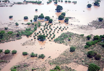
Unveiling the seasonal inundation dynamics and water-balance of the Mara Wetland, Tanzania through multi-temporal Random Forests classification of Sentinel-2 satellite imagery
The Mara Wetland in Tanzania has an important role in regulating the quality, timing and magnitude of the flow of water into Lake Victoria. In addition, the wetland provides natural resources for local communities and habitat for a variety of species. The planned dam construction upstream of the wetland and projected changes in the local climate could affect the physical and ecological equilibrium of the system. Baseline information on seasonal inundation dynamics is necessary to sustainably manage these potential threats. The wetland is sparsely instrumented, which has hampered a thorough temporal and spatial understanding of the local water balance. In addition, the highly vegetated nature of the wetland, and relatively frequent cloud-coverage, motivates multi-source integration of remotely sensed data to capture flood patterns at a high resolution.
In this study, the spatiotemporal inundation pattern of the Mara Wetland in Tanzania is reconstructed using optical remote sensing data. The annual fluctuations in aerial wetland extent are analysed in parallel to the fluctuations of local water balance components: downstream water level of Lake Victoria, upstream discharge, direct precipitation and evaporation. The analysis aims to shed light on the underlying mechanisms and hydrological processes that control the hydric status of the wetland. Comparing the temporal changes in extent with surrounding physical processes provides insight on the responsiveness of the wetland to specific water balance components.
The intra- and inter-annual trends in inundation of the Mara Wetland are reproduced for the years 2017, 2018, 2019. The Random Forests (RF) algorithm is trained bi-seasonally (using bands and derived water and vegetation indices from Sentinel-2 data and a Digital Elevation Model (DEM) as input variables), and used to classify the land-covers of the wetland region in a semi-automated way for a total of 73 Sentinel-2 scenes. The scenes are classified into 7 individual land-cover classes; 3 wetland classes (open water, flooded vegetation, wet floodplain) and 4 dryland classes (dry floodplain, wet agriculture, dry agriculture, bare land). The overall classification accuracy achieved (based on an independent validation set, not used to train the classification algorithm) is 98.6 %. The spatiotemporal variability of the inundated area is used in combination with available hydrological field-data to reproduce the local water balance.
The seasonal expansion and contraction of the wetland follows a consistent bi-modal regime, and the results from the water-balance affirm the importance of local precipitation in the seasonal expansion and contraction of the wetland. The base-flow supplied by the Mara River, together with the backwater from Lake Victoria appear to be at equilibrium at the extent of the permanent swamp during the dry season, insinuating the importance of the river flow during these low-rainfall months. The occasional yet extreme flood events induced by high discharge rates are expected to play a specific ecological role in the wetland, and should be accounted for during future dam operations upstream.
Source: van der Hoek, J. P. 2021. Unveiling the seasonal inundation dynamics and water-balance of the Mara Wetland, Tanzania through multi-temporal Random Forests classification of Sentinel-2 satellite imagery. Early warning systems and climate resilience, Risk & Resilience. AIWW 2021.
In January 2019, De Nederlandsche Bank (DNB) published a report on the ever bigger risks for financial institutions due to water scarcity (notwithstanding risks from floods). Dutch financial institutions have invested at least 97 billion euros in companies in areas of extremely high water scarcity, ranging from soft drink makers to mining groups. Water scarcity can therefore cost the financial sector a lot of money in the coming decades. DNB therefore believes that banks, insurers and pension funds should include these types of risks in their sustainability policy. The majority from the 25 parties investigated by DNB in the financial sector (together accounting for 80% of the invested assets worth at least 1,600 billion euro) do not yet have a well-developed policy for managing water scarcity risks.
In 2018, the first Water Benchmark for financial institutions was developed and carried out by the Water Footprint Network (WFN) in the Netherlands, which is a leading international knowledge partner. On the basis of the water footprint concept, three dimensions were distilled and used in the Water Benchmark, to describe the water sustainability of investment decisions. These dimensions are: efficient allocation, sustainable scale and fair distribution. Efficient allocation revolves around the efficient use of water in the production process, and investigates whether an investment does not unnecessarily waste or contaminate water; sustainable scale compares the total of all water users in the region with ecological ceiling values and analyzes the share of the investment in the total local water use and the possible scarcity that this creates; and the fair distribution criterion provides insight into how the investment usage relates to other users, and asks if the investment does not claim a disproportionate part of the limited available water. More than 50 criteria / questions describe these three sustainability dimensions in both direct operations and the supply chains of investments. Scores are awarded based on the study of publicly available sources and reports released by the financial institutions themselves. The scores describe the degree of sustainable use of water by the companies that are invested in by the rated investor.
The results showed that water sustainability is a blind spot to investors, resulting in disclosed policies being neither well-demarcated nor clearly formulated, especially regarding the supply chain of the activities invested in.
In 2021, WFN together with Water Footprint Implementation have reapplied the assessment framework to the same 20 Dutch large investors with the intent of uncovering trends in the financial sector’s consideration of physical, regulatory, or reputational risk posed by water. We are excited to show who rose and who fell in the rankings and we expect both the water and the financial sector are curious too.
Source: Dobrescu, I. (Water Footprint Implementation). 2021. Water Benchmark for Financial Institutions. Data-driven pathways to approach water-related disasters and challenges, Risk & Resilience. AIWW 2021.
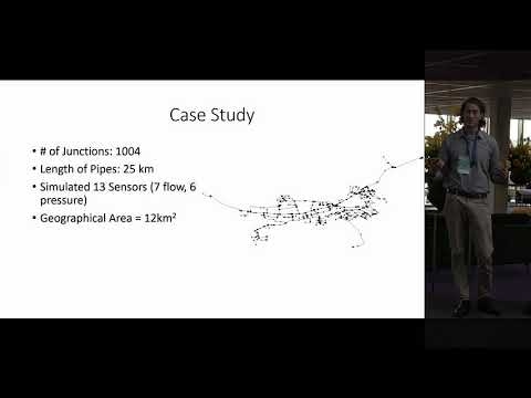
Accelerating Early Warning System Implementation in Water Distribution Networks Through Hydraulic Simulations
The 21st century marks the beginning of the digital transition for the water sector. Many water utilities have begun to utilize sensors to detect and locate water quality hazardous events and pipe bursts throughout their drinking water networks. However, these early warning systems often require a substantial amount of historic data to train machine learning algorithms before detecting anomalies within their own systems. As a result of these data requirements, data collection may be needed to take place for more than a year before the model is operationally functioning. The availability of this data, then, presents a significant barrier to many water utilities who remain hesitant to implement an early warning system given the extensive up-front work required before yielding results.
This paper will present a methodology for filling the gaps of historic data requirements through the application of multiple hydraulic model simulations. These simulations develop an initial set of detection thresholds and calibration of localization model. Data from the hydraulic model simulations are then stored and used to train statistical and machine learning models. This allows the early warning system to be implemented as soon as the sensors are installed. Then, as real data is collected from the sensors, the model is recalibrated to improve anomaly detection and localization.
This work has also designed an open-use FIWARE (www.fiware.org) data model to link hydraulic modelling with real-time sensor observations, which further assists with the initial calibration of the early warning system, as well as its online implementations and data exchange with other applications. The Water Distribution Management Model provides a uniform process to store and run hydraulic models (EPANET input data format). Utilities wishing to implement this process can adopt the online Fiware data model to run and store the hydraulic model.
Overall, the methodology presented in this paper will assist other utilities as they develop their own early warning system by (1) accelerating the calibration process and (2) providing a data model that can house an EPANET model online and assist with hydraulic simulations. The methods and tools developed in this research will be crucial as more utilities develop their own early warning systems and continue to advance their digital water transition.
Source: Snider, B. (University of Exeter). 2021. Accelerating Early Warning System Implementation in Water Distribution Networks Through Hydraulic Simulations. Data-driven pathways to approach water-related disasters and challenges, Risk & Resilience. AIWW 2021.
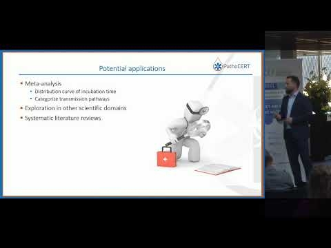
In a pathogen contamination event, ensuring the health of the public should be the top priority in every emergency response mechanism. The immediate control of such incidents is of utmost importance since there is usually a short time to act. Research and innovation are slow to penetrate to protocols and tools related to waterborne pathogen contamination events, as is seen in the current COVID-19 pandemic that raises concerns and questions about the level of preparedness and the health risks of the public.
With the fast-growing rate of scientific publications, the contained information is often buried under the large volume of journal articles. In the field of environmental microbiology, although knowledge and research are abundant in the literature, scientists and experts cannot constantly stay informed on the latest developments. That is why the responsible authorities have uttered the need for a holistic approach to handle waterborne pathogen contamination events by getting immediate access to up-to-date, science-based information. For this purpose, the EU-funded PathoCERT project is launched with the aim of increasing the coordination capability of the responsible authorities. One of the sub-objectives of the project is to develop an Artificial Intelligence (AI) system that extracts information from scientific publications on pathogen characteristics. This automated approach will help them to quickly gain important information, thus enabling them to assess the health risk from a pathogen contamination event and identify potential control actions.
The objective of this research is twofold. Firstly, we want to determine whether it is feasible to extract both qualitative and quantitative information from scientific publications about a waterborne pathogen (Legionella) using Machine Learning (ML) and Text Mining (TM) techniques. Secondly, we want to assess the quality of the extracted information. Legionella was selected, considering that it is a well-known waterborne pathogen that is frequently associated with outbreaks. A Proof of Concept (POC) was utilized to determine whether an Information Extraction (IE) task (a principal subfield of TM) can extract Information Keywords (IK) from scientific publications such as “Incubation period”, “Source of exposure”, “Route of transmission”, “Symptoms”, “Clinical manifestation”, “Species”, and ” Environmental habitat “.
The POC suggested that the system effectively extracted the desired IK. The evaluation of the POC was made using the analytical metrics of precision, and recall which returned a score of 0.91, 0.80, and 0.85 respectively. The high overall scores indicated that the system captures and predicts the IK correctly. The comparison of the system’s performance with manual extraction of information on 10 new scientific publications substantiated this conclusion as similar results were observed, indicating that the quality of the extracted information is adequate.
Overall, the proposed system showed AI could reliably extract both qualitative and quantitative information keywords about Legionella from scientific literature. Our study paved the way for a better understanding of the processes, specifics, and boundary conditions of the desired information, and is considered a first step towards the extraction of information on waterborne pathogens that can help experts in decision-making in an emergency event.
Source: Paraskevopoulos, S. (KWR Water Research Institute, The Netherlands). 2021. Artificial Intelligence and emergencies: An automated approach to extract information from the literature to tackle pathogen contamination events. Data-driven pathways to approach water-related disasters and challenges, Risk & Resilience. AIWW 2021.
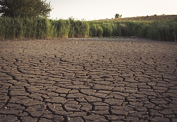
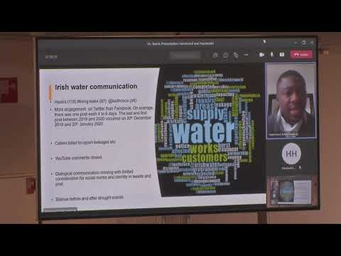
The prevalence and impact of drought has become a growing concern due to its socio-economic, environmental, and health impacts, continuously changing the narrative across different climatic zones. Historical reconstructions indicate that the Republic of Ireland – as a wet country, has experience over 45 droughts events since 1850. The drought events of 2018 and 2020 left a significant impact on water availability and supply, leading to changes in water sector management and policies, including a water conservation ban.
However, the national utility’s communication approach, public perception of water resources availability, and the level of knowledge and awareness on factors that jointly influence water supply such as over-abstraction, climate change, and the extent of media attention have been influencing water conservation efforts and measures particularly during periods of drought. Using sentiment analyses (SA) of social media communication (Facebook and Twitter), newspaper coverage of drought, and stakeholder interviews, our study aimed to catalogue communication lessons from the two drought events of 2018 and 2020 and propose options to enhance public communication on water resource availability in the Republic of Ireland.
Our findings revealed that despite accessible portals providing data and information on water resources, no comprehensive National Drought Information Management System nor national drought policy plan was available as prevailing in many drought-prone countries. Dialogical communication between the national utility company and the public was also limited, while newspaper coverage of drought events changed significantly in 2018 and 2020. Newspaper reports were also framed on uncertainty and risk (41% n=71), which had implications on public support and engagement for water conservation actions instead of stimulating it. Based on our findings, we demonstrated the need for public engagement, multi-sectoral interest and collaborative efforts to communicate drought and water conservation measures. Recommendations made in this study also aim to provide information for effective message development and delivery that could be constructive for water utilities, the media and other water sector organizations as they develop risk communication plans, particularly on drought.
Source: Antwi, S. H. (Centre for Freshwater and Environmental Studies, Dundalk Institute of Technology, Dundalk, Co. Louth, Ireland). 2021. Communicating climate risk in the water sector: A case study of the 2018 and 2020 drought events in the Republic of Ireland. Managing ecological and climate risk, Risk & Resilience. AIWW 2021.
Model System to Protect Endangered Aquatic Species
California is the most populous state in the United States. The sunshine state also contains large fertile lands, placing California in the position to handle a great percentage of the countries agricultural demands. Because of these characteristics there is a high water demand that often prioritizes urban and agricultural demands, leaving ecosystems underrepresented in the water balance. This can be particularly harmful to species whose habitat lies in sensitive streams, who have adapted to historically unimpeded flows.
Two sensitive species include the endangered anadromous Chinook salmon and Steelhead trout. In order to assist a local Californian water utility with protecting these species and implementing environmental flows, a Water Evaluation and Planning (WEAP) model was developed, including an integrated novel biological evaluation framework (BEF). The BEF allows for habitat suitability indexes to be calculated for each endangered species during its various life stages along chosen points of the watershed streams. The combination addresses the pressing issue of integrating ecosystem considerations in water planning, by linking dynamic urban flows with ecological factors at the watershed scale. The model with BEF provides an early warning system for sensitive species, including the Chinook salmon and Steelhead trout. Model outputs predict stream temperature and flow based on predicted climate, utility operations, and imported water supplies. The modeled stream conditions are then compared to the tolerable thresholds of each individual species to predict when habitat conditions will become perilous.
Using modeled results communities can confirm that reservoir releases are providing adequate conditions for the environment, or learn that changes like increased cold water management need to be made to increase survivability of sensitive species. In California the model has been used to influence important ecological decisions. Summer 2021 model predictions estimated high temperatures in Santa Clara stream reaches equating to a low habitat suitability index, putting the endangered species in grave danger. In response to the modeled results, a fish rescue took place in June 2021, saving the endangered fish from potential extinction. In the future the methods used for the BEF could be changed to fit the habitat requirements of other species. When combined with a WEAP model, communities are able to predict and make necessary changes to ensure adequate protection of local endangered species.
Source: Calderon, C. (Stockholm Environment Institute). 2021. Model System to Protect Endangered Aquatic Species. Managing ecological and climate risk, Risk & Resilience. AIWW 2021.
Designing water management strategies which minimize trade-offs between greenhouse gas emissions and flooding risks
The water systems of cities and their surrounding rural areas are often interwoven, which adds another layer of complexity to the challenge of designing adaptive and resilient water management strategies. In particular, cities in peatlands must face the challenge of how to minimize soil subsidence and greenhouse gas (GHG) emissions in the rural areas, without enlarging the impacts of flooding in the urban area. To contribute to our collective understanding how to deal with these conflicting goals, we examine the case of the Waardassackerpolder, a peatland polder of 15.7 km² just South of Amsterdam. The polder is shaped like a bathtub, with urban area with mean elevations ranging from +0.63 m to -0.72 m relative to datum, flanked by rural areas with mean elevations of 2.64–2.28 m below datum.
We assessed the impacts of two water management strategies on soil subsidence, GHG emissions and flooding risks in the timeframe 2021–2051. The first strategy reflects the current policy, with surface water levels in the rural areas that are maintained at 76–103 cm below ground surface. The second strategy reflects a rewetting of the rural peatlands, with surface water levels raised to the ground surface. In both strategies, the surface water levels are periodically lowered to compensate for soil subsidence. First, we assessed the impacts of both strategies on soil subsidence and GHG emissions. Second, we used the resulting surface elevation models as input for an assessment of the time it takes before the first roads in the urban area are flooded, after the surrounding embankment of the rural areas is breeched. All assessments were made with the Tygron Geodesign Platform, with a resolution of 1 by 1 m.
The cumulative soil subsidence of the current policy was 26.8 cm, which resulted in an emission of 24.9 t CO2-eq ha-1 y-1 and mean elevations of the rural areas of 2.91–2.50 m below datum in 2051. After the breech of the embankment, it took 35 hours before the first roads in the urban areas were flooded. The scenario with raised water levels resulted in 1.2 cm subsidence in 30 years (95% decrease) and a GHG emission of 8.9 t CO2-eq ha-1 y-1 (64% decrease). The mean elevations of the rural areas in 2051 were 2.66–2.29 m below datum. As a consequence, less water could be stored in the rural areas after the embankment was breeched. This resulted in a 21 hour window before the first urban roads were flooded.
In this case, trade-offs between reducing GHG emissions and flooding risks were limited, i.e., 64% reduction of GHG emissions could be obtained with 40% less, but still enough time to safely evacuate the residents of the urban areas. In cases where trade-offs are more pronounced, we suggest designing water management strategies that result in slightly more soil subsidence in key rural areas, to allow for adequate evacuation times in urban areas. The Tygron Geodesign Platform can be used for integrated impact assessments that can support such design challenges.
Source: van Hardeveld., H. (Waternet). 2021. Designing water management strategies which minimize trade-offs between greenhouse gas emissions and flooding risks. Managing ecological and climate risk, Risk & Resilience. AIWW 2021.
Unveiling the seasonal inundation dynamics and water-balance of the Mara Wetland, Tanzania through multi-temporal Random Forests classification of Sentinel-2 satellite imagery
The Mara Wetland in Tanzania has an important role in regulating the quality, timing and magnitude of the flow of water into Lake Victoria. In addition, the wetland provides natural resources for local communities and habitat for a variety of species. The planned dam construction upstream of the wetland and projected changes in the local climate could affect the physical and ecological equilibrium of the system. Baseline information on seasonal inundation dynamics is necessary to sustainably manage these potential threats. The wetland is sparsely instrumented, which has hampered a thorough temporal and spatial understanding of the local water balance. In addition, the highly vegetated nature of the wetland, and relatively frequent cloud-coverage, motivates multi-source integration of remotely sensed data to capture flood patterns at a high resolution.
In this study, the spatiotemporal inundation pattern of the Mara Wetland in Tanzania is reconstructed using optical remote sensing data. The annual fluctuations in aerial wetland extent are analysed in parallel to the fluctuations of local water balance components: downstream water level of Lake Victoria, upstream discharge, direct precipitation and evaporation. The analysis aims to shed light on the underlying mechanisms and hydrological processes that control the hydric status of the wetland. Comparing the temporal changes in extent with surrounding physical processes provides insight on the responsiveness of the wetland to specific water balance components.
The intra- and inter-annual trends in inundation of the Mara Wetland are reproduced for the years 2017, 2018, 2019. The Random Forests (RF) algorithm is trained bi-seasonally (using bands and derived water and vegetation indices from Sentinel-2 data and a Digital Elevation Model (DEM) as input variables), and used to classify the land-covers of the wetland region in a semi-automated way for a total of 73 Sentinel-2 scenes. The scenes are classified into 7 individual land-cover classes; 3 wetland classes (open water, flooded vegetation, wet floodplain) and 4 dryland classes (dry floodplain, wet agriculture, dry agriculture, bare land). The overall classification accuracy achieved (based on an independent validation set, not used to train the classification algorithm) is 98.6 %. The spatiotemporal variability of the inundated area is used in combination with available hydrological field-data to reproduce the local water balance.
The seasonal expansion and contraction of the wetland follows a consistent bi-modal regime, and the results from the water-balance affirm the importance of local precipitation in the seasonal expansion and contraction of the wetland. The base-flow supplied by the Mara River, together with the backwater from Lake Victoria appear to be at equilibrium at the extent of the permanent swamp during the dry season, insinuating the importance of the river flow during these low-rainfall months. The occasional yet extreme flood events induced by high discharge rates are expected to play a specific ecological role in the wetland, and should be accounted for during future dam operations upstream.
Source: van der Hoek, J. P. 2021. Unveiling the seasonal inundation dynamics and water-balance of the Mara Wetland, Tanzania through multi-temporal Random Forests classification of Sentinel-2 satellite imagery. Early warning systems and climate resilience, Risk & Resilience. AIWW 2021.
Water is a potential source of contamination of leafy vegetables that have been implicated in food-borne outbreaks. Thus, there is an urgent need to support technologies designed to ensure food safety, including those that disinfect irrigation and processing wash water.
For this lecture, results will be shown for ozone, UV, and membrane filtration when evaluated at the lab scale. Also, results will be shown for UV with and without pre-filtration in a field trial to determine the reduction of Escherichia coli in surface water used to irrigate leafy vegetables. We found that given our case scenario, UV was the most feasible disinfection technology in terms of microbial and cost efficacies to treat surface water used for the agricultural irrigation of crops.
Current research is looking at new possibilities to (re)use fresh water in vegetable processing more efficiently and the possible effects and solutions concerning food safety. The plans for the latest research project targeting Listeria monocytogenes will be presented.
It is pertinent to share how to ensure safety considering the circular economy concept in food systems. The results can provide input into the minimum requirements needed for water disinfection technologies considering its use and reuse of agricultural and processing waters.
Source: Banach, J. 2021. Safe and Save Water: Lessons learned and future endeavors. Decentralised water provisions, pharmaceutical waste removal and safe water, Risk & Resilience. AIWW 2021.
Watch here the online conference on Safe and Save Water.
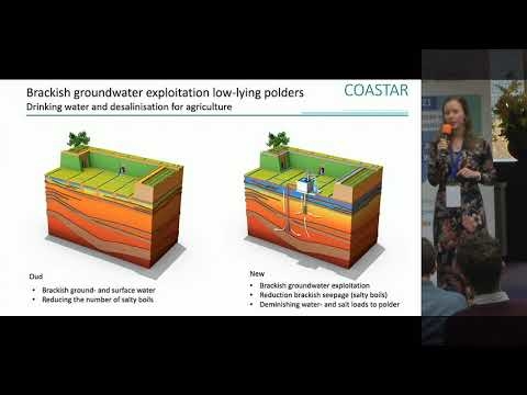
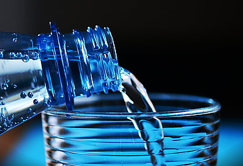
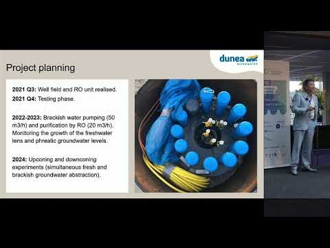
Dunea supplies drinking water to 1.3 million customers in The Hague and surroundings (southwest Netherlands), using a managed aquifer recharge (MAR) scheme installed in the coastal dunes in the 1950s. Pre-treated river water is infiltrated in the coastal dunes to replenish the natural freshwater lens and balance the freshwater extraction for the production of drinking water. The system is effective in maintaining the volume of the freshwater lens, yet further expansion is restricted by the natural hydrogeological conditions, i.e. the presence of brackish groundwater below the lens. Population is growing and thus water demands are increasing, urging Dunea to develop alternative water resources.
One of the options is the use of brackish groundwater for drinking water production. Brackish groundwater is an excellent feed water for (low-pressure) reverse osmosis membranes, and can be desalinated at acceptable (energy) costs. Extracting brackish groundwater below the freshwater lens in the coastal dunes has a second advantage: deep-well extraction causes hydraulic (groundwater) heads to decrease, resulting in a downward shift of the fresh-brackish groundwater interface and an effective growth of the freshwater lens (Zuurbier et al., 2016). Brackish groundwater may thus provide an additional water source and extraction may result in an effective increase in Dunea’s strategic fresh groundwater reserves. These combined benefits of brackish water abstraction are referred to as the Freshman concept (see Figure).
To investigate the potential and optimization of the Freshman concept, a field pilot has been set up at Dunea’s primary drinking water production site in the coastal dunes of The Hague. For the pilot, a multi-screened abstraction well for brackish groundwater has been installed, along with an additional abstraction well for fresh groundwater, multiple monitoring wells, and a facility for collection and desalination of the abstracted brackish groundwater. The pilot will run for three years (2022-2024). The pilot will be used to better characterize the hydrogeology, increase our understanding of fresh-brackish groundwater interactions, validate model results, and to gain operational experience with brackish water desalination. Based on the results of the field test and follow-up modelling studies, Dunea will decide whether brackish groundwater indeed is a feasible drinking water source for the near future. If proven successful, the Freshman concept may be replicated in other coastal areas, where freshwater availability is limited and under increasing pressure due to sea level rise and increasing water demand.
Source: Zwolsman, G. 2021. The LIFE-Freshman project: Feasibility of brackish groundwater as additional drinking water source in the Dutch coastal zone. Additional drinking water sources and circular economy, Risk & Resilience. AIWW 2021.
A Community Management Plus Model for the Governance of Community Drinking Water Systems
Community drinking water systems (CDWS) in Bangladesh and elsewhere of the global south often fail to perform optimally. It is acknowledged that pure community management approach will not reverse this trend. The CDWS end-users need support from the external entities regarding organization of collective action that some have labeled as community management plus (CM+) approach. In order to understand what this support could look like; we particularly zoom in on the role of public agencies.
We ask firstly, what conditions explain variation in collective action among the beneficiaries of CDWS? And secondly, what conditions explain variation in collaboration between CDWS end-users and a public agency? We lean on the concepts and insights drawn from the commons’ literature. After all, community drinking water system can be framed as a common poor resource (CPR). Its users frequently face appropriation and provision dilemmas, that have to be solved to avoid its failure. Based on this literature, we develop a list of enabling conditions for (i) collective action among CDWS end-users, and (ii) collaboration between the CDWS users and public agency.
We applied this list to study the governance of thirty pond sand filter systems (PSF)-community drinking water systems in the Southwestern coastal area of Bangladesh. Computing correlation, the we find that large group size, interdependency among the group members, heterogeneity of endowments, a high level of dependence on PSF system, locally devised access and management rules, and well-working collaboration between PSF users and public agency officials are significantly associated with the occurrence of collective action among the PSF users. We also find that collaboration between PSF users and the public agency) is positively influenced by transparency and inclusive decision-making procedures, but mostly by a relation that is characterized by trust. The study findings have practical implication as it would help the policy makers and practitioners to optimize the implementation strategy of CDWS and thereby helps to avoid the failure of the CDWS in Bangladesh and elsewhere of the similar contexts.
Source: Hasan, B. 2021. A Community Management Plus Model for the Governance of Community Drinking Water Systems: A Comparative Case Study of Pond Sand Filter Systems in Bangladesh. Additional drinking water sources and circular economy, Risk & Resilience. AIWW 2021.
Acceptance and quality assurance of safe irrigation water from municipal wastewater
The irrigation water supply for the greenhouse horticulture sector is under increasing pressure, which is exacerbated by the effects of climate change. Hence, there is a need for alternative water sources for irrigation. In addition, a more general goal is to make water use more circular and to investigate the opportunities for reuse of wastewater in more depth. This includes a situation in which treated wastewater is reused as much as possible, to allow the most sustainable use. This comes together by using treated wastewater as an alternative irrigation source in greenhouse horticulture.
Previous research has shown the possibility of growing tomatoes with effluent that has been treated to be used as irrigation water, without loss of crop quality and yield. However, to further ensure minimal safety risks for people and plants, quality assurance of irrigation water is required. It is expected that this will also support the acceptance of treated effluent as a source for irrigation throughout the chain from grower to consumer. This project carries out a risk inventory and develops a monitoring plan, supported by the relevant stakeholders, that enables the next steps in greenhouse horticulture. To this end, a guideline is developed together with stakeholders in the supply chain, growers, water companies, traders, etc., that describes the conditions that treated effluent (but also wastewater from other sources) must meet to be used as irrigation water. These conditions are both of technological as well as of legislative nature. The continuous measurement of chemical markers, the use of sensors, non-invasive measurement techniques, and decision support systems can be part of the monitoring strategy. This way, more clarity about the assurance of the quality of the water is developed to propose effluent as a technologically feasible – but most of all safe – alternative irrigation source.
In this presentation, an overview of the prevailing legislation and regulations for the use of effluent in greenhouse horticulture is given. This overview includes requirements for water quality parameters to guide tailor-made reprocessing of the effluent for safe cultivation with recycled irrigation water. The prevailing legislations require the quality to be dependent on the risk for (human) health. Therefore, a risk inventory and a framework for a monitoring plan are also made, including smart sensors and data processing for the safe application of irrigation water. By involving the entire chain in stakeholder meetings, important steps are made towards a broad acceptance of the use of effluent as a safe source of irrigation water; from grower to consumer.
Source: de Baat, M. 2021. Acceptance and quality assurance of safe irrigation water from municipal wastewater. Quality assurance, Biodegradation and tools for its assessment. Risk & Resilience. AIWW 2021.
Effect of different types of dissolved organic matter and redox conditions on micropollutant biodegradation by aquifer microbial community
Groundwater, the largest body of freshwater in the European Union (EU), supplies drinking water to about 75% of its residents. Nevertheless, micropollutants, such as pesticides, pharmaceuticals and industrial substances, are detected in European groundwater above the concentration limits set by the EU (0.1 μg/L for individual pesticides and 0.5 μg/L for total pesticides). Removal of micropollutants at the source of contamination is difficult given its diffuse and diverse nature. Micropollutants can enter the water cycle either from point sources, as wastewater treatment plants (WWTPs), or diffuse sources, such as landfills and agricultural fields treated with pesticide or manure. To ensure safe drinking water, drinking water production relies on energy-intensive adsorption or advanced oxidation technologies.
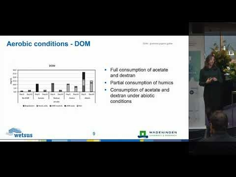
Biodegradation, the major process for natural attenuation of xenobiotics in the environment, could be a cost-effective and sustainable solution. However, groundwater is often oligotrophic and many aquifers are anaerobic, which limits in situ microbial activity and thus micropollutant biodegradation. Recent studies have shown that amendment with dissolved organic matter (DOM) can enhance biodegradation. Therefore, a DOM-based in situ bioremediation technology could be developed to remove micropollutants in groundwater (Figure 1). However, little is known about the mechanism by which DOM supports micropollutants biodegradation.
The aim of this study is to understand how DOM amendment can be used to enhance in situ micropollutant biodegradation in groundwater. Therefore, we investigated the biodegradation of micropollutants frequently found in groundwater by an aquifer microbial culture under two redox conditions, i.e. aerobic and nitrate reducing. The effect of DOM sources with different biodegradability, such as acetate, dextran and humic substances, on micropollutant degradation was evaluated. By monitoring micropollutant transformation, DOM and electron acceptor consumption, as well as microbial community composition and the presence of functional genes for micropollutant degradation, we aim at understanding how different DOM types can enhance micropollutant biodegradation. This is thus a first step towards developing an in situ micropollutant bioremediation technology.
Source: Branco, R. H. R. 2021. Effect of different types of dissolved organic matter and redox conditions on micropollutant biodegradation by aquifer microbial community. Quality assurance, Biodegradation and tools for its assessment. Risk & Resilience. AIWW 2021.
Biostimulation as a tool to assess pesticide biodegradation capacity of microorganisms in groundwater
Groundwater is the main source for drinking water production globally. Groundwater unfortunately can contain micropollutants (MPs) such as pesticides and/or pesticide metabolites. A recent study examining drinking water-abstraction areas covering groundwater and surface water bodies in the Netherlands found pesticides and/or metabolites in 150 out of 226 samples (Sjerps, Kooij, van Loon, & Van Wezel, 2019). Biological remediation of MPs in groundwater requires an understanding of natural biodegradation capacity and the conditions required to stimulate biodegradation activity.
Natural intrinsic biodegradation processes in groundwater can be limited due to (1) supply of electron acceptors, (2) growth substrate, (3) absence of degrading. To assess pesticide biodegradation capacity of field microorganisms, groundwater samples were taken from two monitoring wells located at the north-east of The Netherlands, at five different depths ranging from 13 to 54 m below ground level. Biodegradation of the MPs BAM, MCPP and 2,4-D was assessed in mesocosms with groundwater samples, either without amendment, or with amendment with electron acceptor (nitrate or oxygen) and/or carbon substrate (dissolved organic carbon (DOC). Oxygen+DOC was the most successful amendment resulting in complete biodegradation of 2,4-D in all mesocosms after 42 days.
DOC was most likely used as a growth substrate that enhanced co-metabolic 2,4-D degradation with oxygen as electron acceptor. Different biodegradation rates were observed per groundwater sample. Overall, microorganisms from the shallow aquifer had faster biodegradation rates than those from the deep aquifer. Higher microbial activity was also observed in terms of CO2 production in the mesocosms with shallow groundwater. Longer exposition time to both DOC and MPs could have resulted in microbial adaptation and better biodegradation in shallow samples. Understanding field biodegradation capacity is a key step towards developing further bioremediation-based technologies. Our results show that biostimulation has real potential as a technology for remediating MPs in aquifers in order to ensure safe drinking production.
Source: Aldas-Vargas, A. 2021. Biostimulation as a tool to assess pesticide biodegradation capacity of microorganisms in groundwater. Quality assurance, Biodegradation and tools for its assessment. Risk & Resilience. AIWW 2021.
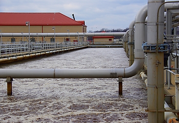
Aerated wetlands as innovative pretreatment for desalination plant for chemical industry
The growing world population leads to an increasing demand for food and water. Moreover, the depletion of resources and the consequences of climate change require industries to reduce their water footprint by using water more efficiently through innovative technologies. Dow Benelux is located in the water-stressed Southwestern Delta of the Netherlands (Terneuzen). Currently, Dow uses 22 million m³ of freshwater annually for the production of 800 different chemicals and plastics. Today, 75% of Dow’s water supply comes from renewable sources. By 2024, the last 4-5 mil m³/year of industrial water use should no longer compete with drinking water resources, making the river basin more resilient to water stress.
One of the alternative local water sources combines i) rainwater collected from the Dow site and its periphery, ii) treated Dow wastewater and iii) treated municipal wastewater from the Terneuzen Waste Water Treatment Plant (WWTP). This water mixture is treated to the required industrial quality in a desalination plant (Ultrafiltration à Ion eXchange à Reverse Osmosis). To increase the efficiency of the desalination and reduce costs, a nature-based pre-treatment (wetland) is investigated with the objective to reduce biological fouling of the membranes with minimal use of energy and chemicals. To the authors’ best knowledge, this is the first study in which outdoor aerated wetlands are applied on such a large scale as pretreatment before a desalination plant.
The pilot setup of wetlands was placed on the Dow/Evides site and is operational since April 2019. It consists of two aerated horizontal subsurface flow wetland cells, based on the Forced Bed AerationTM principle, 350 m² (28 m x 12.5 m x 1 m) each and fed with 10 m³/h municipal effluent from the Terneuzen WWTP and effluent from the Dow WWTP. Both pilot cells are filled with clay aggregates and are aerated in three separate zones by means of blowers, which are connected to aeration grids at the bottom of the wetland cells. The wetland is covered with common reed – Phragmites australis – and the hydraulic residence time in each wetland cell is 12 hours.
After 18 months of research and a variety of settings, it can be concluded that aerated constructed wetlands can supply more biologically stable effluent to the desalination plant. Ammonium was completely removed in the wetlands. The incoming water mixture of the wetland consists of substances that are not easily biodegradable. However, the average low concentrations of COD and TN (25 mg/L and 10 mg/L respectively) are reduced about 25% in the wetland. There was a trade-off found between COD and TN removal, as an increase in the oxygen availability in the filter results in more COD removal and less TN removal. Seasonal variation only affects the removal of TN, where the removal efficiency for municipal wastewater was 38% during summer while being 24% during winter.
These positive results pave the way towards full-scale implementation in the near future.
Source: Martens, M. 2021. Aerated wetlands as innovative pretreatment for desalination plant for chemical industry. Wetlands for wastewater treatment and Nature-Based solutions, Risk & Resilience. AIWW 2021.
Building a Climate Resilience Strategy for Lower Manhattan in a Post-Covid Landscape
For over 400 years, the historic identity of New York City has been rooted in Lower Manhattan. In October 2012, Hurricane Sandy hit New York City and exposed Lower Manhattan’s vulnerabilities to climate change.
Source: Deitz, R., Batten, J., & Hutchinson, E. 2021. Building a Climate Resilience Strategy for Lower Manhattan in a Post-Covid Landscape. Arcadis and NYC Economic Development Corporation.
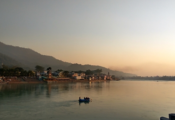
Making Ganga Basin Cities Risk and Climate Resilient
The adverse impact of climate change on water includes less predictable water availability, increased flooding incidences, storm surges and rising case of sea levels which further leads to destruction of water points and sanitation services and contaminates the water sources. In some regions, the droughts are worsening the issue of water scarcity and impacting 40%1 of world’s population in many ways. It is a difficult task to protect and conserve the water quality and quantity, but also provides an opportunity to use water as a leverage for improving ecosystems, economy, agricultural productions, and tackle inequality leading to achieving various Sustainable Development Goals.
Source: Mishra, R. R. 2021. Making Ganga Basin Cities Risk and Climate Resilient. National Mission for Clean Ganga.